The Victorian Walled
Garden
Bohemia House and
Summerfields
![]() Home
Home
![]() History and historic pictures
History and historic pictures
![]() Municipal Vandalism
Municipal Vandalism
![]() Message to our Town
Councillors
Message to our Town
Councillors
![]() Ice House
Ice House
![]() Roman Bath
Roman Bath
![]() Victorian Walled Garden (Bohemia Walled Garden)
Victorian Walled Garden (Bohemia Walled Garden)
![]() Summerfields Woods
Summerfields Woods
![]() September 2009 - new pictures & Video
September 2009 - new pictures & Video ![]()
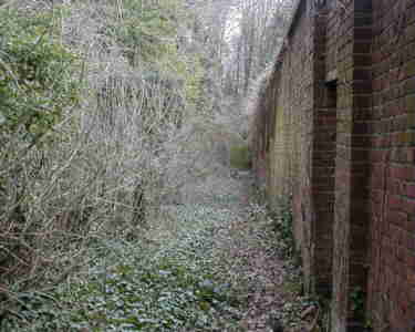
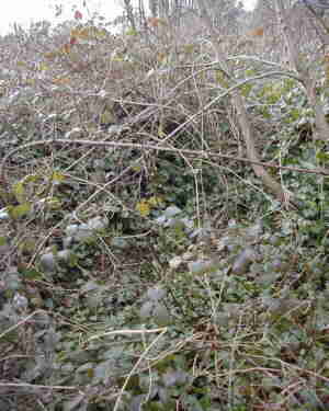
Update from the Bohemia Walled Garden Association. July 2009 Although several years have passed since these pictures were taken of the walled garden, nothing much has changed. Certainly, nothing has improved as far as the material condition of the walled structure is concerned, and the interior growing space is unrecognisable as a useful, horticultural site. Unfortunately, neglect and the absence of human activity have allowed this site to revert to its natural state; the nettles, brambles, and young trees form an impenetrable shoulder-high mass. An added worry is the size and weight of the branches that now overhang the walls from the nearby trees. Some of these have been trimmed back by the Friends of Summerfields Wood, but the largest branches will require more than the energy and enthusiasm of local volunteers using hand tools. To tackle the job of structural restoration and to create a walled garden that is again a scene of horticultural activity, a group of local people have formed the "Bohemia Walled Garden Association". The first meeting was held in January 2009. The BWGA is now a fully constituted organisation and is working with determination and perseverance to make this walled garden into a real community asset. Hastings Borough Council, the owners of the site, have recognised the commitment that the group has shown. The Council is keen to see this site restored and offers its cooperation and advice. The "Bohemia Walled Garden Association" is presently seeking funding from various sources and has had some success. But much more needs to be found. If anyone would like to send a donation or learn more about what the BWGA is doing, please write to: [email protected] The pictures below are a little out-of-date but some more pictures and a couple of videos have been added here
|
|
The walled garden located at O/S map reference TQ 80950975 was built after construction of Bohemia House
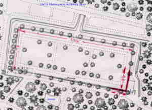
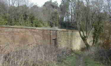
click here for bigger picture It was constructed on sloping ground and on the northwest, northeast, and southeast are substantial retaining walls constructed outside the walled garden in order to retain the hillside |
The rear wall, from the sealed doorway looking south |
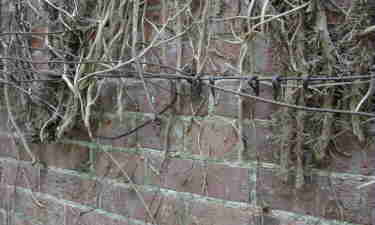
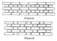
Detail of the outside rear wall showing the english bond brickwork and rings & wires used to hold pear trees to the wall. Local Historian, Ron Fellows, relates how he used to 'scrump' pears there during the war. |
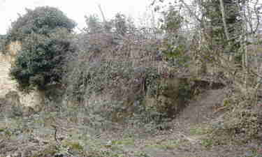
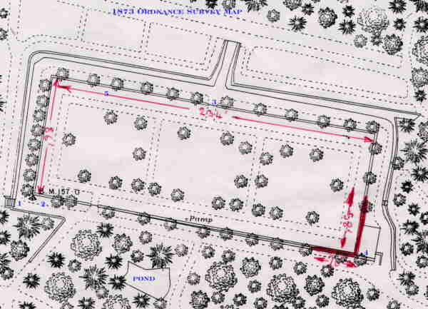
The most seriously damaged corner, see bottom right of map above or click here for larger map |
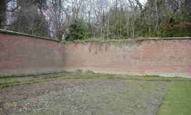
The walled garden is constructed of brick being 234' long and 84' wide and just over 12' high without any buttresses. The 1' 2" wide wall is constructed in English Bond style and is topped by a sandstone plinth.( The Buildings of Sussex Nicholas Pesvner Glossary page 649) The external southwest side of the walled garden is attractively faced in sandstone.
|
|
The very attractive sandstone facing to the wall |
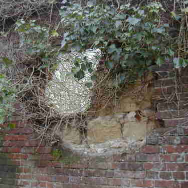
Obscured by ivy on the outside, this damaged section shows how the sandstone facing was effected (Victorian Stone Cladding?) |
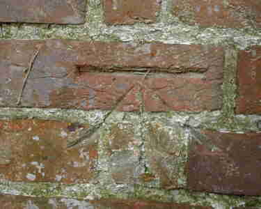
Benchmark on the wall - the height above sea level is recorded on the 1873 map above |
The steps mentioned in the text above are beneath these brambles |
| The wall at the southwest corner of the garden has collapsed and the possibility of rebuilding should be investigated. Currently Mr Jim Corrigan the Borough Conservation Officer is investigating proposals for its restoration. | |
Looking to the inside top left of the garden, notice the staining of decay where coping stones are missing from the top of the wall, if these were replaced the wall would probably last another 130 years. |
The entrance to the garden, from the overgrown steps, the wall changes from brick to sandstone faced |
Click here for Hillsborough Walled Garden and list of many others - Hastings Borough Council might find some inspiration here!
![]()
![]()
![]()
![]()
![]()
050122 010706 050904 070618 071123 080719 081017 090719 091229 100116 160530
 From ground level the 45 courses of bricks making a total of about 105,000 bricks used above ground.
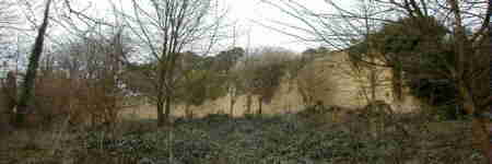